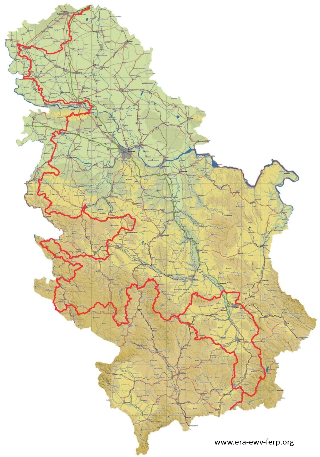
European long-distance paths are a network of long trails connecting different parts of the continent, allowing travellers to experience the diversity of landscapes, cultures and history by walking. The E7 European long-distance path, designed by the European Ramblers’ Association, passes through the western part of Serbia. E7 starts at Palić, then goes through Bač, Novi Sad, Zasavica, Rajac and Zlatibor, continues to Sopotnica, and then through Kopaonik and Đavolja Varoš (Devil’s Town) reaches Vranje. It is 2,113 kilometres long and marked with red and yellow.
On the territory of Novi Sad, the route of the E7 road runs along the Bačka side of the bank of the Danube and passes by the Begečka Jama Nature Park and the settlements of Futog and Veternik. Then it enters Novi Sad and goes through the old city centre and crosses the Žeželj Bridge to the Srem side. The road then passes through Petrovaradin, then goes to Sremski Karlovci, passing by Tekije and Vezirac. At the Stražilovo excursion site, it enters the Fruška Gora National Park. Through the territory of the mountain, the road passes by the monasteries of Grgeteg, Staro and Novo Hopovo, Vrdnička Ravanica, Jazak, Mala Remeta and Bešenovo. The famous Vrdnik spa is also located on its route.
The route of the E7 European long-distance path is 6,460 kilometres long and it passes through Portugal, Spain, Andorra, France, Italy, Slovenia, Hungary and Serbia, connecting the Atlantic with the Balkans. This diverse route takes hikers through landscapes ranging from the Mediterranean coasts, through the Central European plains, to the Balkan mountains, offering an impressive experience of Europe’s natural beauty and cultural heritage.
Navigation for the E7 European long distance-path can be downloaded HERE.